
Get started with Bus Vallarta
Once Bus Vallarta has found your location simply select ” Find your Bus ” and enter your destination in the search box that is displayed on the next screen. A complete set of steps will be presented for you to complete your trip. Close the steps screen to view the full map displaying start , stop and any transfer points you may need and with access to other features such as cost and trip durations. If you are currently not in Puerto Vallarta the search feature will automatically start you at the Puerto Vallarta airport. When using Bus Vallarta please follow and obey all traffic laws for your safety. You will find the bus operators to be helpful and friendly and despite any language barriers they will do there best to aid you in anyway.
Continue reading below for complete details.
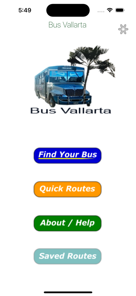
Main Screen
Select to open the search function to find a bus route
A list of some of our users favourite destinations
This site 
Saved routes for offline use.
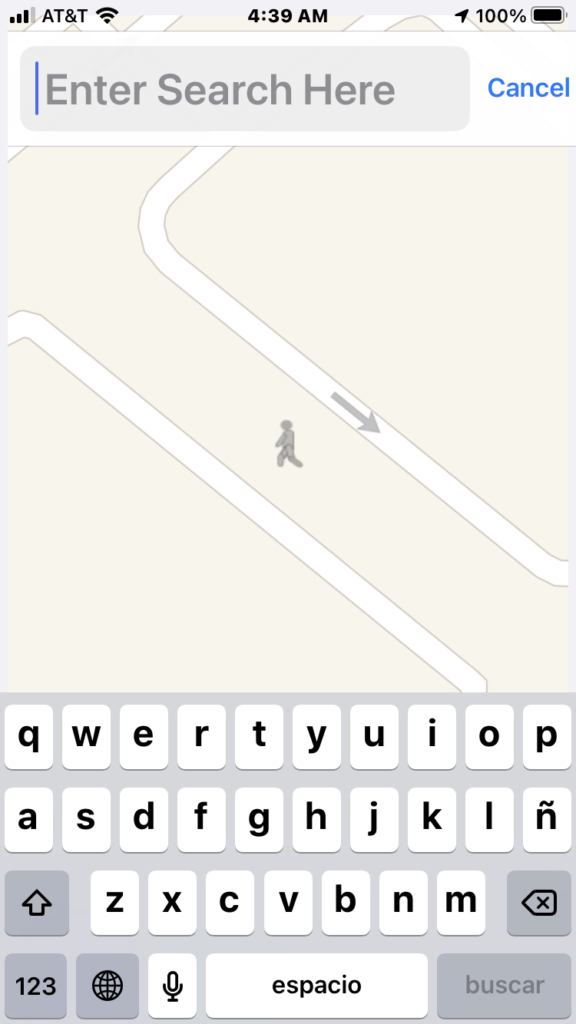
Search for your destination
The search function will be displayed after selecting ” Find your bus ” .
Enter your destination or search for items like Restaurants
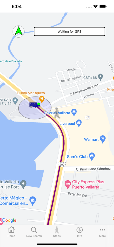
The route/directions screen
When you have selected a destination the routes screen will be displayed showing your bus stops and transfers points if required.
Home Button : Takes you back to the main screen.
New Search : Opens the location search bar
Steps: Displays your directions in a simple text format.
Info : Some basic route information
More : Some options like saving your route for later offline use or changing your current location to check out future routes.
The compass arrow is a directional aid that will point you in the direction of your next stop or transfer. This can be very useful in the busy city center to navigate you in the right direction. When walking please use all precautions and follow all basic traffic rules.
The stops bar indicates the next stop or transfer you are currently on route to. When you are within 20 meters of the displayed point the bar will update automatically to the next destination point.
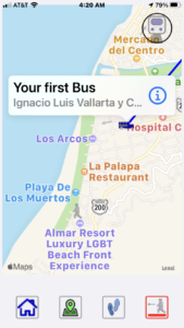
Your location on the map
Your first bus. Your trip starts here
Your transfer out marker. Exit here for your first transfer. Transfer markers that contain a green dot are verified stops. If any of the transfer markers are missing the green circle they are a approximate stop consult your driver if more information is needed.
Your bus stop transfer in marker. If a second transfer is required the second stop markers will be a darker color
If both transfer points are at the same location this icon will be displayed
Your final bus stop
Your destination
Select this item to access other basic route information such as total cost or trip duration when available
Using the new location feature
When first selecting the new location feature your search box will display ” Enter new Location “. Type and select the starting destination you would like to use for accessing possible bus routes. Once your new location is selected search for your bus routes as described at the beginning of this help section. When using Bus Vallarta outside of Puerto Vallarta area your location will be first set at the airport , you may change this location by using the new location feature. Please note that the directions aid is disabled when setting a new location.
Selecting Markers
When tapping on a maps marker a dialog will be presented identifying the markers purpose and the street location. In this dialog tapping the Info marker will draw a walking path to the next corresponding marker. No walking paths will be enabled between points that you would be on the bus.